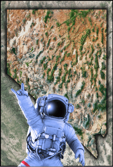


The Answer Is No One Knows How Many Illegal Grows There are in California
As of 2013, illicit marijuana cultivation was quite a destructive force on the environment in California which led state water regulators to conclude they had to become bold/strict in enforcing laws. For that, they would need to know where cannabis is cultivated in the state and how much there was. Almost 10 years after, they still have no answer. So a plan to map illegitimately grown marijuana from space was carried out by the Los Angeles Times.
MAPPING CANNABIS FROM SPACE
Satellite imaging makes it simple to identify marijuana operations. In clear-cut swaths of woodland or wide stretches of desert, plastic-covered hoop homes and patches of single dark-green plants are conspicuous and difficult to miss.
The Times surveyed about 3,000 square miles of land in portions of 6 counties: Trinity, Shasta, Siskiyou, Butte, San Bernardino, and Mendocino using 2021 satellite pictures from a combination of private and public sources.
The survey measured the size of greenhouses and recorded the number of outdoor production locations. It refrained from regions with some other active cultivation that might be mistaken for marijuana and kept an eye out for obvious indications of marijuana, like outdoor swimming pools that could hold water and outside plots next to hoop houses.
ILLEGAL GROWS IN CALIFORNIA
These grows were deemed illegal based on license maps from county permit databases, the Department of Cannabis Control, tax assessor parcel records, and hemp registrations. Ownership maps acquired from the United States Bureau of Indian Affairs were also employed in the findings in Native American communities where special ordinances occasionally allow commercial growing.
The investigation revealed significant changes in where and how cannabis is grown by comparing these 2021 maps to ones made 4-5 years earlier using satellite capturing. California also deployed drones to help spot illegal marijuana grows.
Since California lowered punishments for unauthorized enterprises as part of legalization, illicit marijuana manufacturing had surged in every observed location. Between regions that legalized marijuana and where it was prohibited, there wasn't much difference. The results imply that efforts to entice marijuana cultivators into the legitimate market are failing. In Trinity County, below Post Mountain, 714 of the 782 marijuana farms had no state license as of the beginning of 2022.
ATTEMPTS TO FIND ILLICIT GROWS
A similar system is used by marijuana researchers at UC Berkeley to chart and evaluate changes in cannabis growing. Counties in El Dorado and Humboldt also employ satellite images to track down illegal growers and enforce regional cannabis laws.
Following concerns from Butte and several counties that the inability to stop illegal operations undermined the federal Clean Water Act, California started its endeavor to map cannabis in 2013. In addition to the establishment of marijuana law enforcement units by the state's several environmental agencies, the California Water Resources Control Board hired a commercial contractor to locate cannabis farms in 2015.
The findings were outdated and lacking. The corporation avoided federal and agricultural properties and only looked at satellite photographs for a small portion of California's terrain. The 29,000 "facilities" designated as cannabis grows comprised not only gardens and greenhouses but also retail malls, and due to the lengthy procedure, the maps were outdated.
INTRODUCTION OF CANNABIS MAPPING SOFTWARE
In 2017, a state engineer very close to the California Water Resources Control Board began work on creating a quicker, more thorough tool. He created a machine-learning computer that automatically identifies marijuana cultivation on high-resolution satellite photos. Staff at the agency called it CannaVision.
CannaVision was able to canvass whole regions overnight and locate cannabis fields that the state contractor missed, by 2022. Staff at state agencies were very interested in the program since they had been searching for marijuana crops for years, which had damaged streams and endangered wildlife.
Over eight months, talking point documents and rough drafts of publications were produced claiming that CannaVision could swiftly spot unlawful sites and direct regulators to where the most environmental harm was occurring.
The program was also said to be able to determine how much cannabis was grown in California, however, state officials mention that it has not been tried yet.
The agency provided Gov. Gavin Newsom's administration its first complete look at CannaVision in August 2020 when it was prepared for public introduction, along with maps demonstrating that illegal production exceeded permitted operations. Nicole Elliott, who is currently the director of the Department of Cannabis Control, served as the governor's representative.
CONTROVERSIES SURROUNDING CANNAVISION
Documents made available through the public records law of the state reveal that the public rollout was canceled days later and that its website was removed.
According to a spokesman for the Department of Cannabis Control, Elliott didn't remember voicing any specific remarks or concerns at the meeting, however to the best of her recollection there was a conversation on data accuracy and usage of the tool as an investigative resource." CannaVision was just developing and a formal release would be premature, according to the water agency, after staff got reservations about the reliability of the data from anonymous participants following the meeting with Elliott.
The initiative was thus soon shrouded in secrecy. To keep CannaVision from the public spotlight and immune from public records release, water officials sought legal counsel.
Internal conversations reveal that they found it difficult to justify keeping CannaVision secret. Questions covered whether a private corporation could copy the software for financial gain and whether CannaVision may make illegal growers easy targets for theft. One year later, privacy issues were once more brought up to block The Times access to CannaVision's unprocessed maps. The water agency promised to exclusively offer maps that reflect the density of greenhouses for every square mile.
An agency spokesman attempted to distort CannaVision's singular emphasis on cannabis by implying that it could also be used to locate avocado crops during the nine months it took the state agency to make the documents and emails used to compile this report public. CannaVision, however, was welcomed internally as a tool to combat unlawful cultivation.
BOTTOM LINE
It isn't easy to figure out the number of illicit cannabis farms in the state, although CannaVision was created to do just that, it has not been given the proper chance to fly. Mapping out cannabis farms using satellites is a good method to gauge the amount of cannabis farms out there.
SPOTTING CANNABIS GROWS FROM SPACE, READ ON..